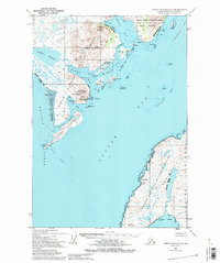
1952 Map of Trinity Islands D-1
USGS Topo · Published 1994About this map
Akhiok anchors this coastal survey, reflecting the remote maritime character of southwestern Kodiak Island in the early 1950s. The settlement's infrastructure is concentrated around Alitak Bay, where a Cannery, Seaplane Base, and Landing Strip supported the region's vital fishing industry. These features illustrate the logistical complexity of life on the archipelago, where air and sea transport provided the only links between isolated outposts.
Find a feature on this map
39 named features on this map. Tap any name to fly to it.
Don’t see what you’re looking for? This feature index may not catch every label — zoom into the map to look around manually.
Map Details
Editions of this 1952 Trinity Islands D-1 Map
3 editions found
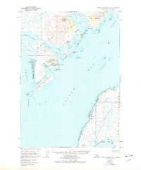
Other maps of this area

1951 · Kaguyak
USGS Topo · 1:250,000

1951 · Trinity Islands
USGS Topo · 1:250,000

1951 · Karluk
USGS Topo · 1:250,000

1952 · Kodiak
USGS Topo · 1:250,000

1952 · Kaguyak
USGS Topo · 1:250,000

1952 · Karluk
USGS Topo · 1:250,000

1952 · Trinity Islands D-2
USGS Topo · 1:63,360

1952 · Trinity Islands D-1
USGS Topo · 1:63,360

1952 · Karluk A-1
USGS Topo · 1:63,360

1952 · Kaguyak D-6
USGS Topo · 1:63,360