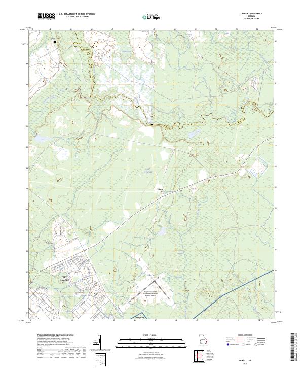
2024 Map of Trinity
USGS Topo · Published 2024About this map
Canoochee River and Canoochee Creek wind through a landscape defined by the expansive military presence of Fort Stewart in Liberty and Bryan counties. This modern survey illustrates the proximity of civilian and military operations, particularly where the settlement of Flemington sits just south of the Wright Army Airfield. The interior terrain is a mosaic of wetlands and low-lying basins, including Alligator Bay, Goshen Swamp, and Big Swamp. Local history is anchored by markers like Trinity Cem and Thomas Hill Cem, which stand near the small settlement of Trinity. A dense network of roads such as Rally Point Rd, Vanguard Rd, and Victory Division Dr reflects the logistical needs of the installation, contrasting with the natural drainage patterns of Peacock Creek and Savage Creek.
Find a feature on this map
50 named features on this map. Tap any name to fly to it.
Don’t see what you’re looking for? This feature index may not catch every label — zoom into the map to look around manually.
Map Details
Editions of this 2024 Trinity Map
This is the sole edition of this map. No revisions or reprints were ever made.
Other maps of this area

1918 · Hinesville
USGS Topo · 1:62,500

1920 · Pembroke
USGS Topo · 1:62,500

1920 · Meldrim
USGS Topo · 1:62,500

1920 · Limerick
USGS Topo · 1:62,500

1942 · Meldrim
USGS Topo · 1:62,500

1944 · Hinesville
USGS Topo · 1:62,500

1944 · Limerick
USGS Topo · 1:62,500

1946 · Brunswick
USGS Topo · 1:250,000

1947 · Savannah
USGS Topo · 1:250,000

1948 · Brunswick
USGS Topo · 1:250,000