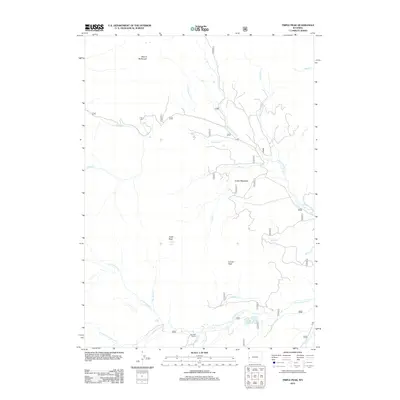
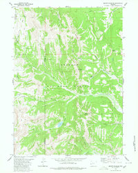
2012 Map of Triple Peak
USGS Topo · Published 2012About this map
Triple Peak and the high ridges of Mount McDougal define this high-elevation landscape in Lincoln County, where complex drainage networks feed into the major forks of Cottonwood Creek. The map reveals a high-country environment where narrow forest roads like 125 and 10050 navigate between prominent summits and alpine basins. The presence of Tie-Hack Cabins near Hidden Basin Cr suggests the area's legacy of timber work, specifically the harvesting of railroad ties that once fueled the expansion of Western transit lines. High meadows such as Foster Meadows and geologic features like the Triplet Vents punctuate the terrain between the north and south forks. Water resources are plentiful, with Soda Lake and numerous named tributaries including Lander Cr, Nylanden Cr, and Sjhoberg Cr carving deep paths through the mountain massif.
Find a feature on this map
37 named features on this map. Tap any name to fly to it.
Don’t see what you’re looking for? This feature index may not catch every label — zoom into the map to look around manually.
Map Details
Editions of this 2012 Triple Peak Map
This is the sole edition of this map. No revisions or reprints were ever made.
Other maps of this area

1921 · Afton
USGS Topo · 1:125,000

1939 · Big Piney
USGS Topo · 1:125,000

1942 · Big Piney
USGS Topo · 1:125,000

1955 · Preston
USGS Topo · 1:250,000

1958 · Preston
USGS Topo · 1:250,000

1962 · Preston
USGS Topo · 1:250,000
1980 · Red Castle Creek
USGS Topo · 1:24,000
1980 · Blind Bull Creek
USGS Topo · 1:24,000
1980 · Triple Peak
USGS Topo · 1:24,000
1980 · Mount Schidler
USGS Topo · 1:24,000