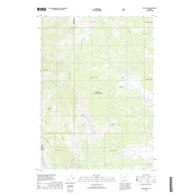
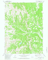
2017 Map of Triple Peak
USGS Topo · Published 2017About this map
The Wyoming Range dominates this high-altitude landscape along the border of Lincoln and Sublette Counties, where peaks like Mt McDougal and Triple Peak reach above the surrounding river basins. This 2017 survey details the complex drainages of the Bridger National Forest, centered on the headwaters of S Cottonwood Cr and N Cottonwood Cr. The map highlights a significant network of recreational and historical paths, including the Wyoming Range NRT Section K and the Wy Range Nat Rec Trail, which navigate the steep ridgelines. Geologic and natural features such as the Triplet Vents near Triple Peak and the secluded Soda Lake at the foot of Lander Peak indicate the varied alpine terrain. Small clearings like Foster Meadows provide breaks in the timbered slopes, while naming conventions like Old Indian and Eagle Creek suggest long-standing mountain travel corridors.
Find a feature on this map
42 named features on this map. Tap any name to fly to it.
Don’t see what you’re looking for? This feature index may not catch every label — zoom into the map to look around manually.
Map Details
Editions of this 2017 Triple Peak Map
This is the sole edition of this map. No revisions or reprints were ever made.
Other maps of this area

1921 · Afton
USGS Topo · 1:125,000

1939 · Big Piney
USGS Topo · 1:125,000

1942 · Big Piney
USGS Topo · 1:125,000

1955 · Preston
USGS Topo · 1:250,000

1958 · Preston
USGS Topo · 1:250,000

1962 · Preston
USGS Topo · 1:250,000
1980 · Red Castle Creek
USGS Topo · 1:24,000
1980 · Blind Bull Creek
USGS Topo · 1:24,000
1980 · Triple Peak
USGS Topo · 1:24,000
1980 · Mount Schidler
USGS Topo · 1:24,000