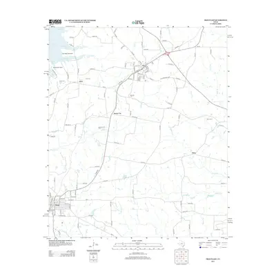
2012 Map of Troup East
USGS Topo · Published 2012About this map
Lake Tyler defines the northwestern corner of this East Texas survey, where the Twin Bay Peninsula and Grand View Point reach into the water near several smaller coves. The landscape is primarily rural, marked by the active Good Omen Oil Field and the scattered settlements of Omen, Sinclair City, and Arp. The town of Troup occupies the southwestern edge, showing a concentrated grid of streets and municipal buildings.
Find a feature on this map
119 named features on this map. Tap any name to fly to it.
Don’t see what you’re looking for? This feature index may not catch every label — zoom into the map to look around manually.
Map Details
Editions of this 2012 Troup East Map
This is the sole edition of this map. No revisions or reprints were ever made.
Other maps of this area

1935 · Henderson
USGS Topo · 1:48,000

1936 · Kilgore
USGS Topo · 1:48,000

1937 · Troupe
USGS Topo · 1:48,000

1938 · Winona
USGS Topo · 1:48,000

1939 · Henderson
USGS Topo · 1:62,500

1940 · Kilgore
USGS Topo · 1:62,500

1943 · Troup
USGS Topo · 1:62,500

1943 · Winona
USGS Topo · 1:62,500

1956 · Tyler
USGS Topo · 1:250,000

1966 · Hope Pond
USGS Topo · 1:24,000