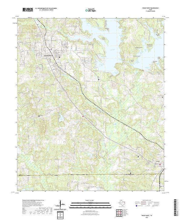
2022 Map of Troup West
USGS Topo · Published 2022About this map
The town of Whitehouse anchors the northwestern corner of this East Texas survey, where the suburban landscape meets the sprawling waters of Lake Tyler. This 2022 dataset captures the intricate shoreline of the lake, including named features like Possum Park Peninsula and Windy Peninsula, alongside smaller water bodies like Grove Club Lake and Dodds Lake. The terrain is defined by a network of creek systems, most notably Kickapoo Cr, Mud Cr, and Blackhawk Cr, which carve through the wooded hills between Whitehouse and Troup.
Find a feature on this map
129 named features on this map. Tap any name to fly to it.
Don’t see what you’re looking for? This feature index may not catch every label — zoom into the map to look around manually.
Map Details
Editions of this 2022 Troup West Map
This is the sole edition of this map. No revisions or reprints were ever made.
Other maps of this area

1937 · Troupe
USGS Topo · 1:48,000

1938 · Winona
USGS Topo · 1:48,000

1943 · Troup
USGS Topo · 1:62,500

1943 · Winona
USGS Topo · 1:62,500

1946 · Bullard
USGS Topo · 1:62,500

1948 · Bullard
USGS Topo · 1:62,500

1948 · Tyler
USGS Topo · 1:62,500

1949 · Tyler
USGS Topo · 1:62,500

1956 · Tyler
USGS Topo · 1:250,000

1966 · Hope Pond
USGS Topo · 1:24,000