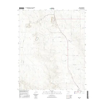
2016 Map of Troy
USGS Topo · Published 2016About this map
Troy remains a quiet focal point in Johnston County, situated along the north-south axis of 3rd St. This 2016 survey illustrates a landscape defined by significant ranching and rural residential tracts, where family names and geographic landmarks dictate the road network. The drainage system is particularly dense, with Mill Creek winding centrally through the terrain, joined by tributaries such as Bee Br and Rock Cr. To the west, the winding paths of Daube Ranch Rd and Sycamore Cr show the persistent influence of large agricultural holdings on the local geography. For those researching family history, the Troy Cem stands as a vital landmark of the community's heritage, while place-names like Ten Acre Rock Rd and Slippery Falls Rd suggest the underlying geology that shapes this part of Oklahoma.
Find a feature on this map
27 named features on this map. Tap any name to fly to it.
Don’t see what you’re looking for? This feature index may not catch every label — zoom into the map to look around manually.
Map Details
Editions of this 2016 Troy Map
This is the sole edition of this map. No revisions or reprints were ever made.
Other maps of this area

1901 · Tishomingo
USGS Topo · 1:125,000

1957 · Ardmore
USGS Topo · 1:250,000

1963 · Ardmore
USGS Topo · 1:250,000

1963 · Mannsville
USGS Topo · 1:24,000

1963 · Sulphur South
USGS Topo · 1:24,000

1963 · Mill Creek
USGS Topo · 1:24,000

1963 · Troy
USGS Topo · 1:24,000

1963 · Ravia
USGS Topo · 1:24,000

1963 · Nebo
USGS Topo · 1:24,000

1967 · Connerville
USGS Topo · 1:24,000