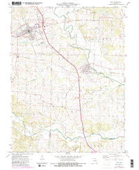
1972 Map of Troy
USGS Topo · Published 1982About this map
Troy and Moscow Mills anchor this topographic study of Lincoln County, showing the region as it transitioned through the 1970s. The landscape is defined by the winding course of the Cuivre River and the expansive Cuivre River State Park to the northeast. Transportation patterns are clearly visible, contrasting the active Burlington Northern line with an Old Railroad Grade that traces the river valley.
Find a feature on this map
26 named features on this map. Tap any name to fly to it.
Don’t see what you’re looking for? This feature index may not catch every label — zoom into the map to look around manually.
Map Details
Editions of this 1972 Troy Map
3 editions found
Other maps of this area

1890 · Louisiana
USGS Topo · 1:125,000

1890 · Hermann
USGS Topo · 1:125,000

1903 · O'Fallon
USGS Topo · 1:125,000

1934 · Elsberry
USGS Topo · 1:48,000

1937 · Silex
USGS Topo · 1:62,500

1939 · Silex
USGS Topo · 1:48,000

1941 · Troy
USGS Topo · 1:62,500

1942 · Elsberry
USGS Topo · 1:62,500

1943 · Warrenton
USGS Topo · 1:62,500

1945 · Troy
USGS Topo · 1:62,500