Loading...
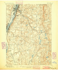
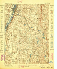
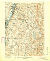
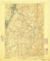
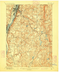
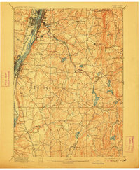
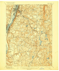
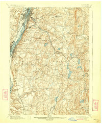
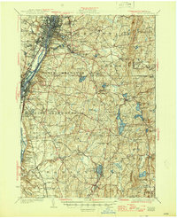
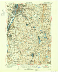
Loading map...1898 Map of Troy
USGS Topo · Published 1900About this map
Industrial and transit corridors dominate the landscape along the Hudson River at the close of the 19th century. The bustling centers of Troy, West Troy, and Green Island are defined by an intricate network of infrastructure, including the Erie Canal and the Delaware and Hudson Railroad. To the east, the terrain transitions into the upland communities of Brunswick, Poestenkill, and Nassau, where the economy relied on water power from the Poesten Kill and Wynant Kill.
Find a feature on this map
92 named features on this map. Tap any name to fly to it.
Don’t see what you’re looking for? This feature index may not catch every label — zoom into the map to look around manually.
Map Details
Date Portrayed1898
Date Published1900
PublisherU.S. Geological Survey
Map TypeTopographic
Scale1:62,500
Physical Dimensions16.6 x 20.1 inches
Editions of this 1898 Troy Map
8 editions found
Historical Maps of Albany Through Time
6 maps found


Featured Locations
Source Details
SourceU.S. Geological Survey
CopyrightPublic Domain