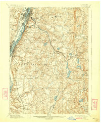
1898 Map of Troy
USGS Topo · Published 1924About this map
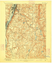
Industrial nodes and rural corridors intersect along the eastern banks of the Hudson River in this late 19th-century landscape. The urban centers of Troy, Watervliet, and Green Island are defined by an intricate convergence of transportation technology, where the Erie Canal and Champlain Canal meet major rail lines like the Delaware and Hudson Railroad. Moving east into the uplands of Sandlake and Brunswick, the scenery shifts to a network of creeks and ponds that powered earlier localized industries, including the glass works at Glasshouse and various mills along the Poesten Kill. This topography illustrates the transition from the river-level transit hubs to the high ridges of Curtis Mountain and Grafton. Genealogists will find interest in the dispersed hamlets such as Defreestville, Sliter, and Barberville, alongside specific family-named landmarks like Hallenbeck and Feller Hill.
Find a feature on this map
84 named features on this map. Tap any name to fly to it.
Don’t see what you’re looking for? This feature index may not catch every label — zoom into the map to look around manually.
Map Details
Editions of this 1898 Troy Map
8 editions found

Other maps of this area

1888 · Berlin
USGS Topo · 1:62,500

1888 · Pittsfield
USGS Topo · 1:62,500

1890 · Pittsfield
USGS Topo · 1:62,500

1890 · Berlin
USGS Topo · 1:62,500

1893 · Cohoes
USGS Topo · 1:62,500

1893 · Troy
USGS Topo · 1:62,500

1893 · Schenectady
USGS Topo · 1:62,500

1893 · Coxsackie
USGS Topo · 1:62,500

1893 · Pittsfield
USGS Topo · 1:62,500

1893 · Albany
USGS Topo · 1:62,500