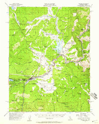
1955 Map of Truckee
USGS Topo · Published 1959About this map
Truckee serves as the hub of this Sierra Nevada landscape in the mid-1950s, where the Southern Pacific railroad follows the sharp bends of the Truckee River. The map captures a moment of transition in the timber and transit economy, marking several defunct operations like Old Schaeffer Mill (Site) and Union Mills (Site), while showing the active industrial infrastructure of the Farad Powerhouse and the Boca Dam holding back the Boca Reservoir.
Find a feature on this map
84 named features on this map. Tap any name to fly to it.
Don’t see what you’re looking for? This feature index may not catch every label — zoom into the map to look around manually.
Map Details
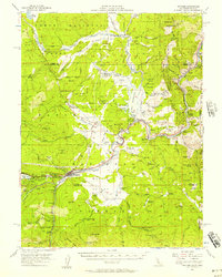
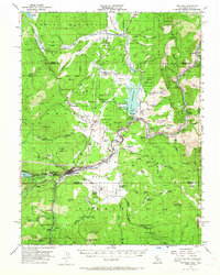
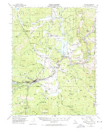
Editions of this 1955 Truckee Map
4 editions found
Other maps of this area

1890 · Sierraville
USGS Topo · 1:125,000

1891 · Carson
USGS Topo · 1:125,000

1891 · Truckee
USGS Topo · 1:125,000

1891 · Reno
USGS Topo · 1:125,000

1892 · Sierraville
USGS Topo · 1:125,000

1893 · Carson
USGS Topo · 1:125,000

1893 · Truckee
USGS Topo · 1:125,000

1893 · Reno
USGS Topo · 1:125,000

1894 · Sierraville
USGS Topo · 1:125,000

1895 · Truckee
USGS Topo · 1:125,000