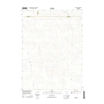
2014 Map of Tryon NE
USGS Topo · Published 2014About this map
The high plains of the Nebraska Sandhills are defined by an intricate network of ridgelines and depressions, where three counties converge in a sparsely populated landscape. This 2014 survey documents the meeting point of Hooker, Thomas, and McPherson counties. The terrain is marked by the absence of permanent water bodies, reflecting the unique drainage characteristics of this region. Human presence is concentrated along a handful of unpaved tracks, most notably Hall Church Rd and Cemetery Rd, which hint at the location of local landmarks and historical community centers. These names suggest the enduring importance of local institutions in a vast, open territory where road names like Ringgold Rd provide the primary geographic orientation across the shifting elevations.
Find a feature on this map
8 named features on this map. Tap any name to fly to it.
Don’t see what you’re looking for? This feature index may not catch every label — zoom into the map to look around manually.
Map Details
Editions of this 2014 Tryon NE Map
This is the sole edition of this map. No revisions or reprints were ever made.
Other maps of this area

1948 · Thedford
USGS Topo · 1:62,500

1949 · Cody Lake
USGS Topo · 1:62,500

1950 · Thedford
USGS Topo · 1:62,500

1950 · Shimmins Lake
USGS Topo · 1:62,500

1951 · Tryon
USGS Topo · 1:62,500

1951 · Cody Lake
USGS Topo · 1:62,500

1954 · North Platte
USGS Topo · 1:250,000

1956 · North Platte
USGS Topo · 1:250,000

1957 · North Platte
USGS Topo · 1:250,000

1967 · North Platte
USGS Topo · 1:250,000