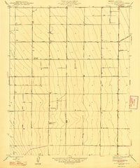
1947 Map of Tufts Ranch
USGS Topo · Published 1947About this map
Large-scale agriculture and early electrical infrastructure define this Central Valley landscape during the mid-1940s. The grid system is anchored by several prominent agricultural holdings, including Tufts Ranch, Murietta Farm, and Coit Ranch, which reflect the region's transition into an industrial farming powerhouse. The survey illustrates a meticulous network of irrigation and utility, evidenced by the numerous marked Wells and the Mendota Sub-Station situated along California Avenue.
Find a feature on this map
29 named features on this map. Tap any name to fly to it.
Don’t see what you’re looking for? This feature index may not catch every label — zoom into the map to look around manually.
Map Details
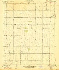
Editions of this 1947 Tufts Ranch Map
2 editions found
Other maps of this area

1913 · Panoche
USGS Topo · 1:125,000

1921 · Mendota
USGS Topo · 1:31,680

1922 · Tufts Ranch
USGS Topo · 1:31,680

1922 · Chaney Ranch
USGS Topo · 1:31,680

1923 · Levis
USGS Topo · 1:31,680

1923 · Wisdom Well
USGS Topo · 1:31,680

1923 · Englebrecht Ranch
USGS Topo · 1:31,680

1923 · Firebaugh
USGS Topo · 1:31,680

1923 · Monocline Ridge
USGS Topo · 1:31,680

1924 · Tranquillity
USGS Topo · 1:31,680