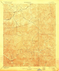
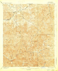
1900 Map of Tujunga
USGS Topo · Published 1922About this map
The Southern Pacific R. R. cuts through the northern reaches of this landscape, connecting early settlements like Acton, Ravenna, and Soledad along the corridor of Soledad Canyon. Surveyed in the late 1890s, the map reveals a rugged terrain dominated by the high ridges of the Santa Barbara National Forest and Angeles National Forest. Mining activity is represented by the Monte Cristo Mines deep in the interior, while scattered human presence is noted at remote outposts such as Hoyt Ranch and Aliso. From the heights of Strawberry Peak and Sister Elsie Pk. down to the drainage of Tujunga Creek, the map documents the complex watershed and early trail networks that preceded the modern expansion of Los Angeles County. Notable landmarks like Pine Flats and Kentucky Springs highlight the importance of water and high-altitude geography in this early frontier era.
Find a feature on this map
46 named features on this map. Tap any name to fly to it.
Don’t see what you’re looking for? This feature index may not catch every label — zoom into the map to look around manually.
Map Details
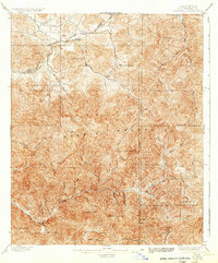
Editions of this 1900 Tujunga Map
7 editions found
Other maps of this area

1894 · Los Angeles
USGS Topo · 1:62,500

1894 · Pomona
USGS Topo · 1:62,500

1896 · Pasadena
USGS Topo · 1:62,500

1896 · Santa Monica
USGS Topo · 1:62,500

1897 · Pomona
USGS Topo · 1:62,500

1898 · Pomona
USGS Topo · 1:62,500

1898 · Santa Monica
USGS Topo · 1:62,500

1900 · Pasadena
USGS Topo · 1:62,500

1900 · Tujunga
USGS Topo · 1:62,500

1900 · Los Angeles
USGS Topo · 1:62,500