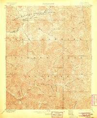
1900 Map of Tujunga
USGS Topo · Published 1905About this map
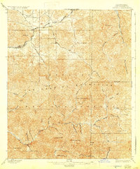
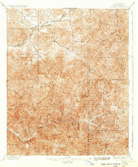
The Southern Pacific RR cuts through the northern canyons of the San Gabriel Timber Land Reserve, following a route that connects the settlements of Acton, Ravenna, and Soledad. This high-altitude landscape is defined by the steep drainage basins of Tujunga Creek and the West Fork San Gabriel River, where mining and ranching outposts established a tenuous foothold. The Monte Cristo Mines sit isolated in the interior, reachable only by winding trails through the complex topography of Gleason Mt. and Strawberry Peak. Downstream, the Hoyt Ranch represents the early agricultural development of these mountain valleys. The map documents an era before the massive infrastructure of modern Los Angeles, showing the region as a protected timber and forest reserve defined by primitive roads and family-named peaks like Mt. Emma and Parker Mt.
Find a feature on this map
43 named features on this map. Tap any name to fly to it.
Don’t see what you’re looking for? This feature index may not catch every label — zoom into the map to look around manually.
Map Details
Editions of this 1900 Tujunga Map
7 editions found
Other maps of this area

1894 · Los Angeles
USGS Topo · 1:62,500

1894 · Pomona
USGS Topo · 1:62,500

1896 · Pasadena
USGS Topo · 1:62,500

1896 · Santa Monica
USGS Topo · 1:62,500

1897 · Pomona
USGS Topo · 1:62,500

1898 · Pomona
USGS Topo · 1:62,500

1898 · Santa Monica
USGS Topo · 1:62,500

1900 · Pasadena
USGS Topo · 1:62,500

1900 · Tujunga
USGS Topo · 1:62,500

1900 · Los Angeles
USGS Topo · 1:62,500