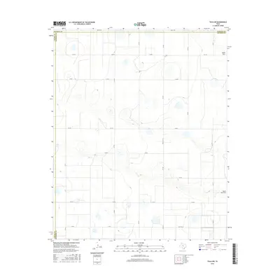
2016 Map of Tulia NW
USGS Topo · Published 2016About this map
North Tule Draw meanders across this High Plains landscape, marking the northern reaches of Swisher County at the boundary with Randall County. The terrain is characterized by the distinct depressions of N Tule Lake and the drainage of Happy Draw, illustrating the playa lake systems and intermittent watercourses typical of the Texas Panhandle. A rigid grid of rural roads, including Happy W Rd and various numbered county routes, defines the agricultural footprint of the region. Major transit corridors like Ranch Rd 1424 and FM 1075 provide the primary links between scattered farmsteads and ranching operations. The survey documents the area's hydrology and transportation network near the tri-county junction of Randall, Castro, and Swisher counties, capturing the essential infrastructure of this rural cattle and cotton-producing territory.
Find a feature on this map
24 named features on this map. Tap any name to fly to it.
Don’t see what you’re looking for? This feature index may not catch every label — zoom into the map to look around manually.
Map Details
Editions of this 2016 Tulia NW Map
This is the sole edition of this map. No revisions or reprints were ever made.
Other maps of this area

1954 · Plainview
USGS Topo · 1:250,000

1954 · Clovis
USGS Topo · 1:250,000

1958 · Clovis
USGS Topo · 1:250,000

1958 · Plainview
USGS Topo · 1:250,000

1960 · Canyon
USGS Topo · 1:62,500

1961 · Buffalo Lake
USGS Topo · 1:62,500

1965 · Tulia
USGS Topo · 1:24,000

1965 · Lakeview
USGS Topo · 1:24,000

1965 · Happy
USGS Topo · 1:24,000

1965 · Nazareth
USGS Topo · 1:24,000