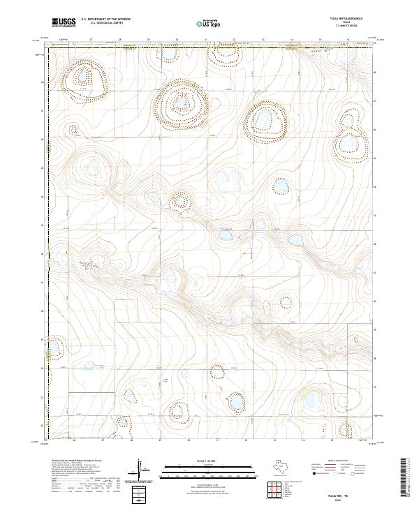
2022 Map of Tulia NW
USGS Topo · Published 2022About this map
North Tule Draw and Happy Draw carve their way through the high plains of the Texas Panhandle in this modern topographic study of Swisher County. The landscape is defined by its agricultural grid, where a network of county roads like Co Rd 8 and Co Rd C intersect with state-maintained routes including Fm 1075. This quadrangle captures the rural transition where Swisher meets both Randall and Castro Counties, evidenced by the clear administrative boundaries along the map's northern and western edges. The presence of North Tule Lake in the west provides a rare hydrological focal point in an area dominated by dry draws and ephemeral drainage patterns. The map detail reflects the persistence of ranching and farming infrastructure, from the prominent Ranch Rd 1424 to the numerous smaller section roads that facilitate the movement of goods across this sparsely populated section of the Llano Estacado.
Find a feature on this map
23 named features on this map. Tap any name to fly to it.
Don’t see what you’re looking for? This feature index may not catch every label — zoom into the map to look around manually.
Map Details
Editions of this 2022 Tulia NW Map
This is the sole edition of this map. No revisions or reprints were ever made.
Other maps of this area

1954 · Plainview
USGS Topo · 1:250,000

1954 · Clovis
USGS Topo · 1:250,000

1958 · Clovis
USGS Topo · 1:250,000

1958 · Plainview
USGS Topo · 1:250,000

1960 · Canyon
USGS Topo · 1:62,500

1961 · Buffalo Lake
USGS Topo · 1:62,500

1965 · Tulia
USGS Topo · 1:24,000

1965 · Lakeview
USGS Topo · 1:24,000

1965 · Happy
USGS Topo · 1:24,000

1965 · Nazareth
USGS Topo · 1:24,000