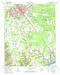
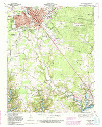
1972 Map of Tullahoma
USGS Topo · Published 1973About this map
The aerospace and defense footprint of the Arnold Engineering Development Center (U S Air Force) dominates the eastern landscape of this early 1970s survey, illustrating the Cold War era's impact on Middle Tennessee. Adjacent to these high-tech facilities, the Arnold Wildlife Management Area preserves a significant expanse of wooded terrain, while the developing shoreline of Tims Ford Lake reflects a shift toward recreation. Evidence of this transition appears at the Holiday Marina and Resort (construction) near Estill Springs. In Tullahoma itself, the municipal layout is anchored by the Louisville and Nashville railroad corridor, which services local industry and the University of Tennessee Agricultural Experiment Station. Longstanding community roots are visible in the numerous family burial grounds and churchyards, including Maplewood Cem, Evergreen Cem, and Oakwood Cem.
Find a feature on this map
79 named features on this map. Tap any name to fly to it.
Don’t see what you’re looking for? This feature index may not catch every label — zoom into the map to look around manually.
Map Details
Editions of this 1972 Tullahoma Map
5 editions found
Other maps of this area

1928 · Decherd
USGS Topo · 1:62,500

1936 · Ovoca
USGS Topo · 1:24,000

1936 · Manchester
USGS Topo · 1:24,000

1936 · Cumberland Springs
USGS Topo · 1:24,000

1936 · Winchester
USGS Topo · 1:24,000

1936 · Belvidere
USGS Topo · 1:24,000

1936 · Camp Peay
USGS Topo · 1:24,000

1936 · Capitol Hill
USGS Topo · 1:24,000

1936 · Normandy
USGS Topo · 1:24,000

1936 · Lois
USGS Topo · 1:24,000