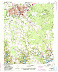
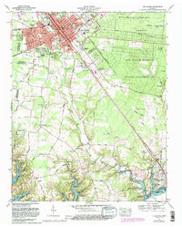
1972 Map of Tullahoma
USGS Topo · Published 1993About this map
The city of Tullahoma serves as the focal point of this regional study, showing a developed urban center transitioning into the sprawling grounds of the Arnold Air Force Base. To the south, the landscape is defined by the winding course of the Elk River and the significant reach of Tims Ford Lake, which borders settlements like Estill Springs and Eastbrook. The map captures a moment of institutional and agricultural development, featuring the Highland Rim Experimental Farm and the Tennessee Correction Academy. Transportation is anchored by the Louisville and Nashville railroad corridor and the Lynchburg Highway. Local history is well-preserved through numerous family-named burial grounds including Pylant Cem, Gault Cem, and Chastain Cem, alongside rural congregations like New Center Grove Ch and Allen Chapel.
Find a feature on this map
97 named features on this map. Tap any name to fly to it.
Don’t see what you’re looking for? This feature index may not catch every label — zoom into the map to look around manually.
Map Details
Editions of this 1972 Tullahoma Map
5 editions found
Other maps of this area

1928 · Decherd
USGS Topo · 1:62,500

1936 · Ovoca
USGS Topo · 1:24,000

1936 · Manchester
USGS Topo · 1:24,000

1936 · Cumberland Springs
USGS Topo · 1:24,000

1936 · Winchester
USGS Topo · 1:24,000

1936 · Belvidere
USGS Topo · 1:24,000

1936 · Camp Peay
USGS Topo · 1:24,000

1936 · Capitol Hill
USGS Topo · 1:24,000

1936 · Normandy
USGS Topo · 1:24,000

1936 · Lois
USGS Topo · 1:24,000