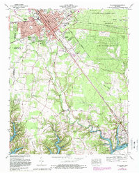
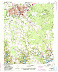
1972 Map of Tullahoma
USGS Topo · Published 1988About this map
The city of Tullahoma serves as the focal point of this Coffee County survey, shown during a period of significant regional infrastructure development. The Louisville and Nashville Railroad bisects the town, anchoring a grid of residential neighborhoods like Pipeview Heights and Bel-Aire. To the southeast, the creation of Tims Ford Lake has reshaped the landscape, with the Holiday Marina and Resort and Lakeside Estates appearing along the new shoreline of the Elk River basin.
Find a feature on this map
80 named features on this map. Tap any name to fly to it.
Don’t see what you’re looking for? This feature index may not catch every label — zoom into the map to look around manually.
Map Details
Editions of this 1972 Tullahoma Map
5 editions found
Other maps of this area

1928 · Decherd
USGS Topo · 1:62,500

1936 · Ovoca
USGS Topo · 1:24,000

1936 · Manchester
USGS Topo · 1:24,000

1936 · Cumberland Springs
USGS Topo · 1:24,000

1936 · Winchester
USGS Topo · 1:24,000

1936 · Belvidere
USGS Topo · 1:24,000

1936 · Camp Peay
USGS Topo · 1:24,000

1936 · Capitol Hill
USGS Topo · 1:24,000

1936 · Normandy
USGS Topo · 1:24,000

1936 · Lois
USGS Topo · 1:24,000