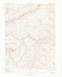
1942 Map of Tungsten
USGS Topo · Published 1969About this map
Barker Reservoir and the mining-driven settlement of Nederland anchor this 1942 survey, revealing a landscape defined by water management and mineral extraction. The mountain terrain is carved by the Denver and Salt Lake RR, which snakes through the canyon following South Boulder Creek. Local industrial history is marked by the presence of the Kekionga Mine and the Manchester Mine, while smaller ranching and community hubs like Pine Cliff, Rollinsville, and Wondervu dot the topography.
Find a feature on this map
51 named features on this map. Tap any name to fly to it.
Don’t see what you’re looking for? This feature index may not catch every label — zoom into the map to look around manually.
Map Details
Editions of this 1942 Tungsten Map
5 editions found

Other maps of this area

1899 · West Denver
USGS Topo · 1:125,000

1902 · Boulder
USGS Topo · 1:62,500

1904 · Boulder
USGS Topo · 1:62,500

1905 · Central City
USGS Topo · 1:62,500

1906 · Blackhawk
USGS Topo · 1:62,500

1910 · Central City
USGS Topo · 1:62,500

1912 · Central City
USGS Topo · 1:62,500

1915 · Longs Peak
USGS Topo · 1:125,000

1919 · Rocky Mountain National Park
USGS Topo · 1:125,000

1942 · Eldorado Springs
USGS Topo · 1:24,000