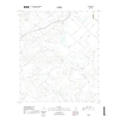
2019 Map of Tunis
USGS Topo · Published 2019About this map
Tunis and the surrounding rangelands of Brazos and Burleson counties appear here as a landscape defined by meandering creek beds and long-established family sites. The northeastern corner is bounded by the Brazos River and the oxbow remnant of the Old River, while the interior is drained by an intricate network of waterways including Reed Cr, Carrington Cr, and Deep Cr. Genealogy researchers will find significant value in the distribution of local burial grounds, such as Old Bethlehem Cem near Tunis and the more isolated Carr Cem, Salem Cem, and Draper Cem to the north. The road network, including the Presidential Corridor E, follows the natural contours of the terrain, weaving between local landmarks like Palmer Lake and several smaller seasonal drainages such as Sessums Br and Rocky Br.
Find a feature on this map
65 named features on this map. Tap any name to fly to it.
Don’t see what you’re looking for? This feature index may not catch every label — zoom into the map to look around manually.
Map Details
Editions of this 2019 Tunis Map
This is the sole edition of this map. No revisions or reprints were ever made.
Other maps of this area
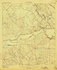
1914 · Gay Hill
USGS Topo · 1:62,500

1954 · Austin
USGS Topo · 1:250,000
1956 · Bryan
USGS Topo · 1:62,500
1956 · Caldwell
USGS Topo · 1:62,500
1956 · Somerville
USGS Topo · 1:62,500
1960 · Lyons
USGS Topo · 1:24,000
1960 · Snook
USGS Topo · 1:24,000
1960 · Frenstat
USGS Topo · 1:24,000
1961 · Caldwell
USGS Topo · 1:24,000
1961 · Mumford
USGS Topo · 1:24,000