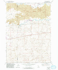
1971 Map of Tunupa
USGS Topo · Published 1993About this map
The Big Wood River and Little Wood River converge in this high-desert landscape, where the geology of the Lava flows dictates the path of both natural water and irrigation infrastructure. The small settlement of Tunupa sits at a critical junction of hydraulic engineering, marked by a Diversion Dam and Powerhouse that managed the river's flow for early agricultural development. The terrain is a complex network of volcanic formations and man-made channels, including the Main Canal, which cuts across the Gooding Co Lincoln Co boundary. Researchers of Idaho's water history will find significant detail in the placement of the Sliman Reservoir and various water works like the Jones Wendell Well, illustrating the 20th-century effort to reclaim this arid region through concerted engineering and persistence.
Find a feature on this map
13 named features on this map. Tap any name to fly to it.
Don’t see what you’re looking for? This feature index may not catch every label — zoom into the map to look around manually.
Map Details
Editions of this 1971 Tunupa Map
2 editions found
Other maps of this area

1955 · Twin Falls
USGS Topo · 1:250,000

1955 · Hailey
USGS Topo · 1:250,000

1957 · Thorn Creek SE
USGS Topo · 1:24,000

1957 · Thorn Creek SW
USGS Topo · 1:24,000

1957 · Thorn Creek
USGS Topo · 1:62,500

1958 · Twin Falls
USGS Topo · 1:250,000

1959 · Hailey
USGS Topo · 1:250,000

1962 · Hailey
USGS Topo · 1:250,000
1971 · Wendell
USGS Topo · 1:24,000

1971 · Tunupa
USGS Topo · 1:24,000