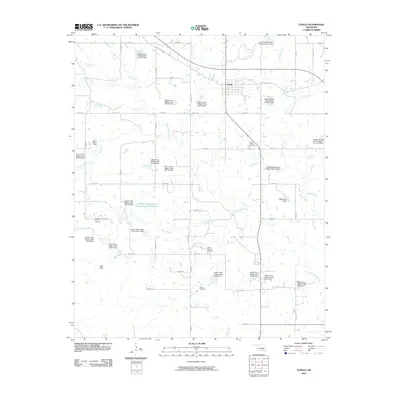
2010 Map of Tupelo
USGS Topo · Published 2010About this map
The town of Tupelo serves as the central hub of this Coal County landscape, where the local economy is defined by a dense network of water management and energy extraction. Numerous flood control structures, such as Upper Clear Boggy Creek Site 54 Dam and the Leader Middle Clear Boggy Creek 13 Dam, dictate the flow of several waterways including Leader Creek and Clear Boggy Creek. These engineering projects support the surrounding agricultural lands and the Clarita Oil and Gas Field in the southern portion of the quadrangle.
Find a feature on this map
53 named features on this map. Tap any name to fly to it.
Don’t see what you’re looking for? This feature index may not catch every label — zoom into the map to look around manually.
Map Details
Editions of this 2010 Tupelo Map
This is the sole edition of this map. No revisions or reprints were ever made.
Other maps of this area

1896 · Coalgate
USGS Topo · 1:125,000

1899 · Coalgate
USGS Topo · 1:125,000

1899 · Atoka
USGS Topo · 1:125,000

1900 · Atoka
USGS Topo · 1:125,000

1900 · Coalgate
USGS Topo · 1:125,000

1901 · Stonewall
USGS Topo · 1:125,000

1901 · Tishomingo
USGS Topo · 1:125,000

1957 · Stonewall
USGS Topo · 1:24,000

1957 · Centrahoma
USGS Topo · 1:24,000

1957 · Tupelo NE
USGS Topo · 1:24,000