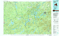
1985 Map of Tupper Lake
USGS Topo · Published 1994About this map
Adirondack Park spans the vast majority of this 1985 survey, revealing a landscape defined by expansive wilderness and isolated logging and recreational settlements. The intricate waterways of the Raquette River and Oswegatchie River connect dozens of significant water bodies, from Cranberry Lake in the west to the cluster of Upper Saranac Lake, Middle Saranac Lake, and Lower Saranac Lake in the east. This map captures the region when the Conrail line still reached into the interior, serving communities like Newton Falls and Piercefield.
Find a feature on this map
60 named features on this map. Tap any name to fly to it.
Don’t see what you’re looking for? This feature index may not catch every label — zoom into the map to look around manually.
Map Details
Editions of this 1985 Tupper Lake Map
2 editions found
Other maps of this area

1895 · Mt. Marcy
USGS Topo · 1:62,500

1896 · Lake Placid
USGS Topo · 1:62,500

1897 · Schroon Lake
USGS Topo · 1:62,500

1898 · Newcomb
USGS Topo · 1:62,500

1898 · Lake Placid
USGS Topo · 1:62,500

1901 · Newcomb
USGS Topo · 1:62,500

1902 · Mt. Marcy
USGS Topo · 1:62,500

1902 · Saranac
USGS Topo · 1:62,500

1903 · Big Moose
USGS Topo · 1:62,500

1903 · Raquette Lake
USGS Topo · 1:62,500