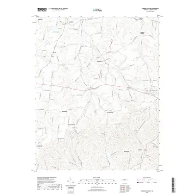
2019 Map of Turners Station
USGS Topo · Published 2019About this map
Westmoreland sits at the eastern edge of this Sumner County landscape, where the terrain transitions from the headwaters of the Middle Fork Drakes Creek toward the Bledsoe Cr drainage. This 2019 survey captures a series of small, interconnected rural communities such as Angeltown, Withamtown, and Pondville that are defined by their location along narrow ridge roads and creek bottoms. The area's genealogical depth is evident in the numerous family and community burial grounds, including the Providence Cem and Butt Cem, which serve as landmarks for the historic farmsteads scattered across the hollows.
Find a feature on this map
118 named features on this map. Tap any name to fly to it.
Don’t see what you’re looking for? This feature index may not catch every label — zoom into the map to look around manually.
Map Details
Editions of this 2019 Turners Station Map
This is the sole edition of this map. No revisions or reprints were ever made.
Other maps of this area

1928 · Adolphus
USGS Topo · 1:48,000

1931 · Lafayette
USGS Topo · 1:62,500

1931 · Adolphus
USGS Topo · 1:62,500

1942 · Gallatin
USGS Topo · 1:100,000

1954 · Petroleum
USGS Topo · 1:24,000
1954 · Hickory Flat
USGS Topo · 1:24,000

1954 · Adolphus
USGS Topo · 1:24,000

1955 · Bethpage
USGS Topo · 1:24,000

1955 · Gallatin
USGS Topo · 1:24,000

1956 · Nashville
USGS Topo · 1:250,000