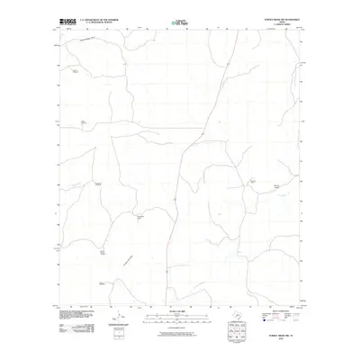
2010 Map of Turney Draw NW
USGS Topo · Published 2010About this map
Whitehead Ranch and Earwood Ranch stand as primary landmarks in this high-plains landscape of Val Verde County, where ranching life is defined by the vital presence of water infrastructure. The survey details a network of strategically placed water sources, including the Buckley Windmill, Kirkendall Windmill, and Mutton Pasture Windmill, which reflect the region's reliance on groundwater to sustain livestock. The terrain is deeply grooved by the ephemeral drainage systems of the Dry Devils River and Turney Draw. These intermittent waterways, along with Dolan Creek and County Line Draw, dictate the movement and settlement patterns across this Texas territory, illustrating how the natural geography of draws and creeks shapes the layout of individual holdings and the access routes between them.
Find a feature on this map
12 named features on this map. Tap any name to fly to it.
Don’t see what you’re looking for? This feature index may not catch every label — zoom into the map to look around manually.
Map Details
Editions of this 2010 Turney Draw NW Map
This is the sole edition of this map. No revisions or reprints were ever made.
Other maps of this area

1954 · Sonora
USGS Topo · 1:250,000

1958 · Sonora
USGS Topo · 1:250,000

1967 · Dunbar Draw SW
USGS Topo · 1:24,000

1967 · Flat Rock Draw SE
USGS Topo · 1:24,000

1967 · Dunbar Draw SE
USGS Topo · 1:24,000

1971 · Turney Draw SE
USGS Topo · 1:24,000
1971 · Turney Draw NE
USGS Topo · 1:24,000

1973 · Turney Draw NW
USGS Topo · 1:24,000

1973 · Robinson Draw
USGS Topo · 1:24,000

1973 · Four Mills
USGS Topo · 1:24,000