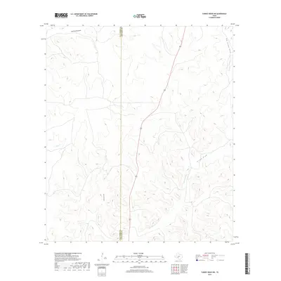
2019 Map of Turney Draw NW
USGS Topo · Published 2019About this map
The boundary between Val Verde and Edwards Counties bisects this high-elevation landscape, where the seasonal drainage network of the Dry Devils River watershed dominates the topography. This 2019 survey captures the vast, arid terrain of the Edwards Plateau, characterized by a complex system of draws that channel rare rainfall into the river basin. The most prominent feature is the winding course of the Dry Devils River, which is fed by significant tributaries like County Line Draw and South Buckley Draw. Transport through this cattle-ranching country is anchored by Highway 277, which cuts a nearly straight line north-south across the high ground between the river and Dolan Creek. The map provides a clear record of these intermittent watercourses, including Turney Draw and Big Turney Draw, which define the eastern reaches of the quadrangle.
Find a feature on this map
8 named features on this map. Tap any name to fly to it.
Don’t see what you’re looking for? This feature index may not catch every label — zoom into the map to look around manually.
Map Details
Editions of this 2019 Turney Draw NW Map
This is the sole edition of this map. No revisions or reprints were ever made.
Other maps of this area

1954 · Sonora
USGS Topo · 1:250,000

1958 · Sonora
USGS Topo · 1:250,000

1967 · Dunbar Draw SW
USGS Topo · 1:24,000

1967 · Flat Rock Draw SE
USGS Topo · 1:24,000

1967 · Dunbar Draw SE
USGS Topo · 1:24,000

1971 · Turney Draw SE
USGS Topo · 1:24,000
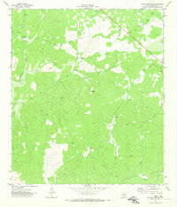
1971 · Turney Draw NE
USGS Topo · 1:24,000

1973 · Turney Draw NW
USGS Topo · 1:24,000

1973 · Robinson Draw
USGS Topo · 1:24,000

1973 · Four Mills
USGS Topo · 1:24,000