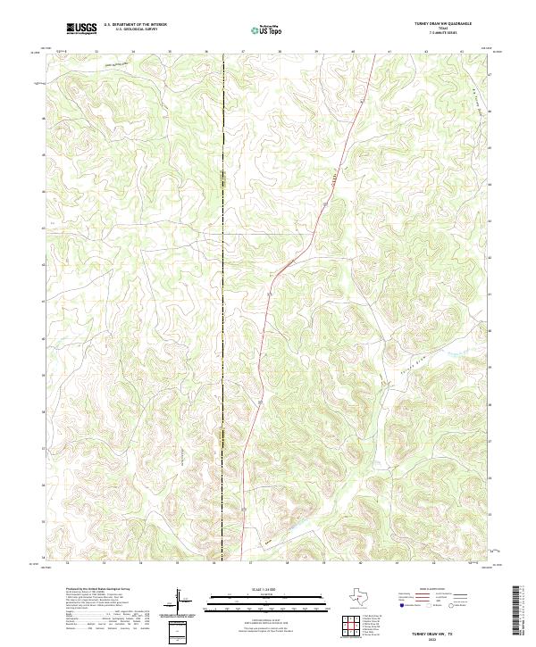
2022 Map of Turney Draw NW
USGS Topo · Published 2022About this map
Val Verde and Edwards county lines bisect this part of the Texas Edwards Plateau, where the landscape is defined by an intricate network of intermittent drainage systems. The Dry Devils River and its major tributaries, including Turney Draw and Big Turney Draw, carve through the high ground, creating a complex series of ridges and canyons. These dry washes, such as South Buckley Draw and County Line Draw, illustrate the region’s hydraulic history where water only flows during significant rain events.
Find a feature on this map
8 named features on this map. Tap any name to fly to it.
Don’t see what you’re looking for? This feature index may not catch every label — zoom into the map to look around manually.
Map Details
Editions of this 2022 Turney Draw NW Map
This is the sole edition of this map. No revisions or reprints were ever made.
Other maps of this area

1954 · Sonora
USGS Topo · 1:250,000

1958 · Sonora
USGS Topo · 1:250,000

1967 · Dunbar Draw SW
USGS Topo · 1:24,000

1967 · Flat Rock Draw SE
USGS Topo · 1:24,000

1967 · Dunbar Draw SE
USGS Topo · 1:24,000

1971 · Turney Draw SE
USGS Topo · 1:24,000
1971 · Turney Draw NE
USGS Topo · 1:24,000

1973 · Turney Draw NW
USGS Topo · 1:24,000

1973 · Robinson Draw
USGS Topo · 1:24,000

1973 · Four Mills
USGS Topo · 1:24,000