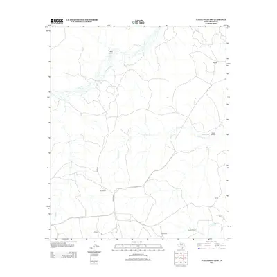
2012 Map of Turtle Hole Camp
USGS Topo · Published 2012About this map
N Pease River meanders across the northern reaches of this ranching landscape in Motley County, carving through the terrain near Dikes Canyon. The area is defined by a sparse network of working camps and vital water infrastructure, a hallmark of West Texas cattle country. Named camps such as Turtle Hole Camp and Lucky Knob Camp provide focal points for local history, while landmarks like Lucky Knob and Baines Flat break the horizon.
Find a feature on this map
19 named features on this map. Tap any name to fly to it.
Don’t see what you’re looking for? This feature index may not catch every label — zoom into the map to look around manually.
Map Details
Editions of this 2012 Turtle Hole Camp Map
This is the sole edition of this map. No revisions or reprints were ever made.
Other maps of this area

1954 · Plainview
USGS Topo · 1:250,000

1958 · Plainview
USGS Topo · 1:250,000

1966 · Fields Canyon
USGS Topo · 1:24,000

1966 · Matador
USGS Topo · 1:24,000

1966 · Ballard Camp
USGS Topo · 1:24,000

1966 · Tee Pee City
USGS Topo · 1:24,000

1967 · North Windmill
USGS Topo · 1:24,000

1967 · Cottonwood Camp
USGS Topo · 1:24,000

1967 · Hornica Creek
USGS Topo · 1:24,000

1967 · Turtle Hole Camp
USGS Topo · 1:24,000