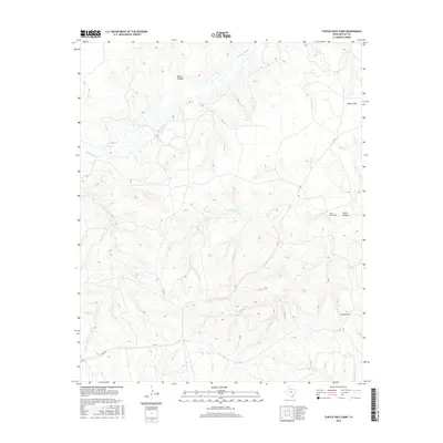
2016 Map of Turtle Hole Camp
USGS Topo · Published 2016About this map
The N Pease River meanders across the northern portion of this Motley County landscape, carving a complex network of drainage systems through the Texas Panhandle. This 2016 survey illustrates a terrain defined by intermittent waterways and significant topographical relief, including Dikes Canyon and South Canyon. The map reveals a rural infrastructure centered on water management and ranching accessibility, as evidenced by features like Crows Nest Tank and the presence of FM 94. The interior is characterized by expansive plains such as Baines Flat and named elevations like Lucky Knob, which serve as primary landmarks in this sparsely populated area. Hydrological features like Turtle Hole Cr, Cottonwood Cr, and Hornica Cr dictate the natural travel corridors and land use patterns, while The Ditch indicates human modification of the natural water flow for agricultural or livestock purposes.
Find a feature on this map
13 named features on this map. Tap any name to fly to it.
Don’t see what you’re looking for? This feature index may not catch every label — zoom into the map to look around manually.
Map Details
Editions of this 2016 Turtle Hole Camp Map
This is the sole edition of this map. No revisions or reprints were ever made.
Other maps of this area

1954 · Plainview
USGS Topo · 1:250,000

1958 · Plainview
USGS Topo · 1:250,000

1966 · Fields Canyon
USGS Topo · 1:24,000

1966 · Matador
USGS Topo · 1:24,000

1966 · Ballard Camp
USGS Topo · 1:24,000

1966 · Tee Pee City
USGS Topo · 1:24,000

1967 · North Windmill
USGS Topo · 1:24,000

1967 · Cottonwood Camp
USGS Topo · 1:24,000

1967 · Hornica Creek
USGS Topo · 1:24,000

1967 · Turtle Hole Camp
USGS Topo · 1:24,000