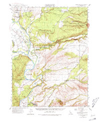
1944 Map of Tuscan Buttes
USGS Topo · Published 1980About this map
The Sacramento River carves a winding path through the borderlands of Shasta and Tehama counties on this 1944 survey, revealing a landscape defined by ranching and early hydraulic engineering. Historical pioneers are represented by the Site of Ft Reading and the Ruins of Reading Adobe, markers of mid-19th-century settlement along the Stillwater Plains. The area’s dependence on the river is evident through the presence of the Coleman Power House and various fisheries including the U S Fish Hatchery and U S Fish Culture Sta.
Find a feature on this map
67 named features on this map. Tap any name to fly to it.
Don’t see what you’re looking for? This feature index may not catch every label — zoom into the map to look around manually.
Map Details
Editions of this 1944 Tuscan Buttes Map
3 editions found

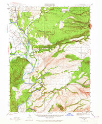
Other maps of this area

1886 · Lassen Peak
USGS Topo · 1:250,000

1890 · Red Bluff
USGS Topo · 1:250,000

1892 · Lassen Peak
USGS Topo · 1:250,000

1894 · Lassen Peak
USGS Topo · 1:250,000

1894 · Red Bluff
USGS Topo · 1:250,000

1901 · Redding
USGS Topo · 1:125,000

1905 · Tehama
USGS Topo · 1:62,500

1935 · Burney
USGS Topo · 1:96,000

1935 · Paynes Creek
USGS Topo · 1:96,000

1939 · Burney
USGS Topo · 1:125,000