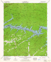
1961 Map of Tuskeegee
USGS Topo · Published 1964About this map
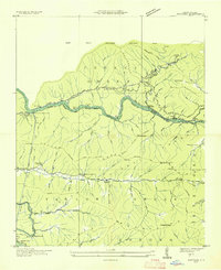
Fontana Lake dominates this 1961 landscape, its winding waters serving as the boundary between the Great Smoky Mountains National Park to the north and the Nantahala National Forest to the south. The map documents a rugged region of western North Carolina defined by high ridges like Welch Ridge and Forneys Ridge. Settlement patterns are concentrated in small pockets such as Tuskeegee and the riverside site of Proctor.
Find a feature on this map
82 named features on this map. Tap any name to fly to it.
Don’t see what you’re looking for? This feature index may not catch every label — zoom into the map to look around manually.
Map Details
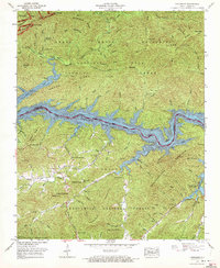
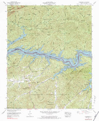
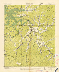
Editions of this 1961 Tuskeegee Map
4 editions found

Other maps of this area

1886 · Knoxville
USGS Topo · 1:125,000

1892 · Knoxville
USGS Topo · 1:125,000

1894 · Knoxville
USGS Topo · 1:125,000

1895 · Knoxville
USGS Topo · 1:125,000

1901 · Knoxville
USGS Topo · 1:125,000

1933 · Bushnell
USGS Topo · 1:62,500
1935 · Robbinsville
USGS Topo · 1:24,000
1935 · Fontana
USGS Topo · 1:24,000

1936 · Proctor
USGS Topo · 1:24,000

1936 · Wesser
USGS Topo · 1:24,000