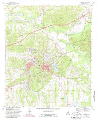
1971 Map of Tuskegee
USGS Topo · Published 1987About this map
Tuskegee Institute stands as a central anchor of this landscape, its campus and the nearby Tuskegee Institute High Sch characterizing the area's development during the early 1970s. The map illustrates a complex institutional and civic environment, including the sprawling Veterans Hospital and the historic Moton Field located north of the city center. This period of Macon County history is marked by a blend of academic, medical, and agricultural activity, with numerous rural congregations like Simmons Temple, Mt Teman Ch, and New Hope Ch dotting the countryside. To the north, the small settlement of Chehaw is positioned along the Seaboard railroad line, while the eastern edge of the quadrangle transitions into the protected timberlands of the Tuskegee National Forest. The map's detailed mapping of Greenwood Cem and Tuskegee Cem provides significant data for those tracing local family lineages and church histories.
Find a feature on this map
42 named features on this map. Tap any name to fly to it.
Don’t see what you’re looking for? This feature index may not catch every label — zoom into the map to look around manually.
Map Details
Editions of this 1971 Tuskegee Map
3 editions found
Other maps of this area

1906 · Dadeville
USGS Topo · 1:125,000

1955 · Phenix City
USGS Topo · 1:250,000

1957 · Phenix City
USGS Topo · 1:250,000

1958 · Phenix City
USGS Topo · 1:250,000

1971 · Little Texas
USGS Topo · 1:24,000

1971 · Carrville
USGS Topo · 1:24,000

1971 · Loachapoka
USGS Topo · 1:24,000

1971 · Tuskegee
USGS Topo · 1:24,000
1971 · Notasulga
USGS Topo · 1:24,000

1971 · La Place
USGS Topo · 1:24,000