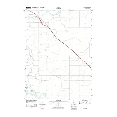
2010 Map of Tuttle
USGS Topo · Published 2010About this map
Thousand Springs and the complex hydrography of the Snake River canyon define this Southern Idaho landscape. The map highlights a significant concentration of aquaculture and water management, including the Hagerman State Fish Hatchery and the Hagerman National Fish Hatchery near the river's edge. The settlement of Tuttle serves as a small hub amidst a grid of rural roads, while the geological drama of the Canyon Rim is punctuated by the Devils Wash Bowl where the Malad River meets the canyon edge.
Find a feature on this map
49 named features on this map. Tap any name to fly to it.
Don’t see what you’re looking for? This feature index may not catch every label — zoom into the map to look around manually.
Map Details
Editions of this 2010 Tuttle Map
This is the sole edition of this map. No revisions or reprints were ever made.
Other maps of this area

1949 · Bliss
USGS Topo · 1:24,000

1949 · Thousand Springs
USGS Topo · 1:24,000

1949 · Gooding Butte
USGS Topo · 1:24,000

1949 · Tuttle
USGS Topo · 1:24,000

1949 · Hagerman
USGS Topo · 1:24,000

1950 · Gooding Butte
USGS Topo · 1:24,000

1950 · Hagerman
USGS Topo · 1:24,000

1950 · Bliss
USGS Topo · 1:24,000

1950 · Niagara Springs
USGS Topo · 1:24,000

1950 · Jerome
USGS Topo · 1:62,500