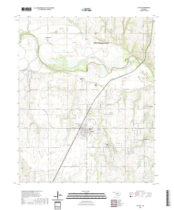
2022 Map of Tuttle
USGS Topo · Published 2022About this map
The Canadian River bisects this landscape as it flows between the borders of Grady and Canadian counties. The central settlement of Tuttle is mapped in detail, showing its grid of streets such as W Main St and S Cimarron Rd. To the north, Union City sits near the winding course of Beaver Cr, while Bridge Creek lies to the southeast. Genealogists will find several burial sites including Silver City Cem, Riverside Cem, and Fairview Cem. The surrounding plains are marked by numerous small tributaries like Snake Creek, Store Cr, and Worley Creek, alongside modern water management features such as the 051038 Reservoir and 051040 Reservoir. The map illustrates the transition from organized municipal centers to the section-line road network that defines the rural Oklahoma countryside.
Find a feature on this map
108 named features on this map. Tap any name to fly to it.
Don’t see what you’re looking for? This feature index may not catch every label — zoom into the map to look around manually.
Map Details
Editions of this 2022 Tuttle Map
This is the sole edition of this map. No revisions or reprints were ever made.
Other maps of this area

1893 · Oklahoma City
USGS Topo · 1:62,500

1893 · Minco
USGS Topo · 1:62,500

1904 · Chickasha
USGS Topo · 1:125,000

1954 · Oklahoma City
USGS Topo · 1:250,000

1956 · Oklahoma City
USGS Topo · 1:62,500

1957 · Oklahoma City
USGS Topo · 1:250,000

1963 · Oklahoma City
USGS Topo · 1:250,000
1965 · Blanchard
USGS Topo · 1:24,000
1965 · Oklahoma City SW
USGS Topo · 1:24,000
1966 · Minco NE
USGS Topo · 1:24,000