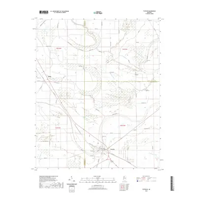
2020 Map of Tutwiler
USGS Topo · Published 2020About this map
Tutwiler stands at a crossroads of the Mississippi Delta, where the borders of Coahoma, Quitman, and Tallahatchie counties converge. This 2020 landscape is defined by its deep agricultural grid and a complex network of slow-moving waterways including Muddy Bayou, Walnut Bayou, and the Upper Quiver River. The settlement of Dublin lies northwest of Tutwiler along a diagonal corridor that follows the path of Old Hwy 49. A striking number of small, dispersed burial grounds are recorded here, such as Rosemound Cem, Galena Cem, and the Hebrew Cem, providing critical anchor points for family historians. The map also captures several sloughs, including Carson Slough and Long Dam Slough, which weave between family-named roads like Leshe Cheairs Rd and Jonestown-Claremont Rd. This survey documents a rural region where small-town life remains tightly tied to the drainage patterns and historical road alignments of the Delta.
Find a feature on this map
71 named features on this map. Tap any name to fly to it.
Don’t see what you’re looking for? This feature index may not catch every label — zoom into the map to look around manually.
Map Details
Editions of this 2020 Tutwiler Map
This is the sole edition of this map. No revisions or reprints were ever made.
Other maps of this area

1931 · Sumner
USGS Topo · 1:48,000

1931 · Drew
USGS Topo · 1:48,000

1932 · Tutwiler
USGS Topo · 1:48,000

1935 · Clarksdale
USGS Topo · 1:62,500

1935 · Sumner
USGS Topo · 1:62,500

1935 · Tutwiler
USGS Topo · 1:62,500

1935 · Mound Bayou
USGS Topo · 1:62,500

1939 · Sumner
USGS Topo · 1:62,500

1939 · Tutwiler
USGS Topo · 1:62,500

1939 · Clarksdale
USGS Topo · 1:62,500