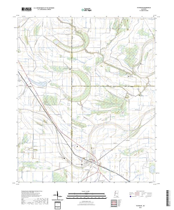
2024 Map of Tutwiler
USGS Topo · Published 2024About this map
Tutwiler and the surrounding Delta landscape of Tallahatchie County are defined by a complex network of bayous and sloughs that dictate the layout of roads and agricultural tracts. The town of Tutwiler serves as a central junction, while the smaller settlement of Dublin lies to the northwest. This modern survey reveals a deep history of community and family life through its numerous burial grounds, including the Rosemound Cem, the Hebrew Cem, and the Tallahatchie County Cem. The winding paths of Walnut Bayou and Muddy Bayou snake through the terrain, intersecting with long-established routes like Old Hwy 49. Near the banks of Upper Quiver River, the map documents local institutions such as Whitfield Baptist Church and several smaller cemeteries like Galena Cem and Bower Cem, providing a detailed view of the region's rural social geography.
Find a feature on this map
72 named features on this map. Tap any name to fly to it.
Don’t see what you’re looking for? This feature index may not catch every label — zoom into the map to look around manually.
Map Details
Editions of this 2024 Tutwiler Map
This is the sole edition of this map. No revisions or reprints were ever made.
Other maps of this area

1931 · Sumner
USGS Topo · 1:48,000

1931 · Drew
USGS Topo · 1:48,000

1932 · Tutwiler
USGS Topo · 1:48,000

1935 · Clarksdale
USGS Topo · 1:62,500

1935 · Sumner
USGS Topo · 1:62,500

1935 · Tutwiler
USGS Topo · 1:62,500

1935 · Mound Bayou
USGS Topo · 1:62,500

1939 · Sumner
USGS Topo · 1:62,500

1939 · Tutwiler
USGS Topo · 1:62,500

1939 · Clarksdale
USGS Topo · 1:62,500