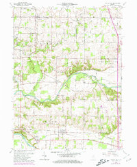
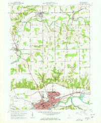
1963 Map of Twelve Mile
USGS Topo · Published 1981About this map
The Wabash River and Eel River systems converge in this section of north-central Indiana, defining the agricultural and industrial layout of Cass and Miami counties. The settlement of Twelve Mile anchors the northern region, while New Waverly sits along the southern rail corridor. Transportation history is deeply etched into the landscape via the Chesapeake and Ohio and Norfolk and Western railroads, which facilitated the growth of rural junctions like Hoover. Beyond the rails, the map preserves the locations of numerous early congregations and burial grounds, including Bethlehem Ch, Corinth Ch, and the Eel River Chapel Cem. The inclusion of the Peru Municipal Airport and a localized Gravel Pit reflects the mid-century modernizing economy, set against the older backdrop of the Indian Treaty Boundary.
Find a feature on this map
35 named features on this map. Tap any name to fly to it.
Don’t see what you’re looking for? This feature index may not catch every label — zoom into the map to look around manually.
Map Details
Editions of this 1963 Twelve Mile Map
4 editions found
Other maps of this area

1951 · Peru
USGS Topo · 1:24,000

1951 · Onward
USGS Topo · 1:24,000

1951 · Twelve Mile
USGS Topo · 1:24,000

1951 · Bunker Hill
USGS Topo · 1:24,000

1953 · Danville
USGS Topo · 1:250,000

1955 · Danville
USGS Topo · 1:250,000

1955 · Logansport
USGS Topo · 1:24,000

1955 · Anoka
USGS Topo · 1:24,000

1956 · Danville
USGS Topo · 1:250,000
1960 · Peru
USGS Topo · 1:24,000