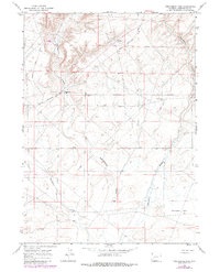
1968 Map of Twelvemile Sink
USGS Topo · Published 1980About this map
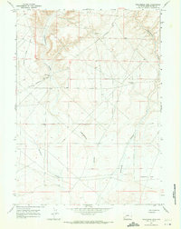
Twelvemile Sink defines this corner of Sweetwater County, a high-desert landscape marked by the deep erosional cuts of Eighteenmile Canyon and Buckhorn Canyon. This 1968 survey (with 1978 updates) illustrates the vital role of water and infrastructure in this arid region, showing the solitary Eighteenmile Well and a Flowing Well as critical landmarks for ranchers or travelers. The Lincoln Sweetwater Road serves as the primary artery through the terrain, connecting remote points across the desert. Evidence of industrial exploration is present through isolated labels such as a Pit and a Drill Hole, reflecting the mineral and resource prospecting common in this part of Wyoming during the late 1960s. The map provides a precise look at the township and range system at the convergence of T. 24 N. and T. 25 N., where the land falls away into the branching reaches of Twelvemile Canyon.
Find a feature on this map
15 named features on this map. Tap any name to fly to it.
Don’t see what you’re looking for? This feature index may not catch every label — zoom into the map to look around manually.
Map Details
Editions of this 1968 Twelvemile Sink Map
2 editions found
Other maps of this area

1954 · Rock Springs
USGS Topo · 1:250,000

1955 · Lander
USGS Topo · 1:250,000

1958 · Lander
USGS Topo · 1:250,000

1958 · Rock Springs
USGS Topo · 1:250,000

1961 · Lander
USGS Topo · 1:250,000

1962 · Rock Springs
USGS Topo · 1:250,000

1963 · Gasson Bridge
USGS Topo · 1:24,000
1963 · Mc Cullen Bluff
USGS Topo · 1:24,000
1963 · Thoman School
USGS Topo · 1:24,000
1968 · Twelvemile Sink
USGS Topo · 1:24,000