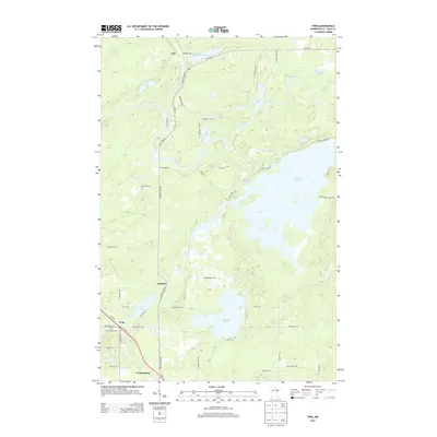
2013 Map of Twig
USGS Topo · Published 2013About this map
Twig and the surrounding woodlands of Saint Louis County appear in this survey, defined by a complex network of glacial lakes and river systems. The Cloquet River and its tributary, the Us-Kab-Wan-Ka River, wind through the northern terrain, feeding into the expansive Fish Lake Reservoir which dominates the eastern portion of the map. Small settlements and points of interest such as Bartlett and Taft are connected by a grid of local roads and trails, including Munger Shaw Rd and Taft Rd.
Find a feature on this map
54 named features on this map. Tap any name to fly to it.
Don’t see what you’re looking for? This feature index may not catch every label — zoom into the map to look around manually.
Map Details
Editions of this 2013 Twig Map
This is the sole edition of this map. No revisions or reprints were ever made.
Other maps of this area

1895 · Duluth
USGS Topo · 1:62,500

1953 · Twig
USGS Topo · 1:24,000

1953 · Canyon
USGS Topo · 1:24,000

1953 · Shaw
USGS Topo · 1:24,000

1953 · Saginaw
USGS Topo · 1:24,000

1953 · Adolph
USGS Topo · 1:24,000

1953 · Duluth Heights
USGS Topo · 1:24,000

1953 · Boulder Lake Reservoir
USGS Topo · 1:24,000

1953 · Fredenberg
USGS Topo · 1:24,000

1953 · Independence
USGS Topo · 1:24,000