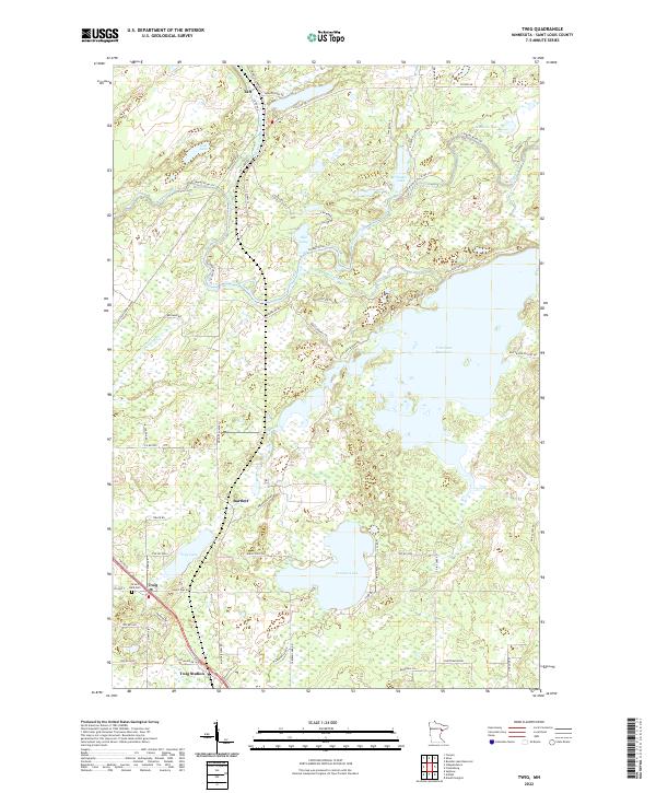
2022 Map of Twig
USGS Topo · Published 2022About this map
Twig and Twig Station anchor the southwestern corner of this Saint Louis County landscape, illustrating a classic Minnesota forest-and-water settlement pattern. The terrain is defined by the expansive Fish Lake Reservoir and the winding course of the Cloquet River, which flows through northern reaches near Taft. A sense of local history is preserved in the presence of the Grand Lake Cem and the traces of an Old Railroad Grade cutting across the northwestern quadrant. These markings, alongside rural clusters like Bartlett, reflect the evolution of timber and transport in the region. The map highlights the transition from managed waterways like Fish Lake Reservoir to natural features such as Caribou Lake and the elevated terrain of Wilderness Ridge. Numerous rural roads, including Munger Shaw Rd and Co Hwy 48, connect these isolated water bodies and small community centers.
Find a feature on this map
69 named features on this map. Tap any name to fly to it.
Don’t see what you’re looking for? This feature index may not catch every label — zoom into the map to look around manually.
Map Details
Editions of this 2022 Twig Map
This is the sole edition of this map. No revisions or reprints were ever made.
Other maps of this area

1895 · Duluth
USGS Topo · 1:62,500

1953 · Twig
USGS Topo · 1:24,000

1953 · Canyon
USGS Topo · 1:24,000

1953 · Shaw
USGS Topo · 1:24,000

1953 · Saginaw
USGS Topo · 1:24,000

1953 · Adolph
USGS Topo · 1:24,000

1953 · Duluth Heights
USGS Topo · 1:24,000

1953 · Boulder Lake Reservoir
USGS Topo · 1:24,000

1953 · Fredenberg
USGS Topo · 1:24,000

1953 · Independence
USGS Topo · 1:24,000