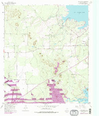
1957 Map of Twin Buttes
USGS Topo · Published 1978About this map
Twin Buttes rises as a prominent landmark in this West Texas landscape, which is defined by a massive hydraulic engineering network near San Angelo. The map documents a period of significant change as the Middle Concho River and Spring Creek are harnessed into the expansive Twin Buttes Reservoir. These waters neighbor the established Lake Nasworthy and O C Fisher Lake, illustrating the region's intense mid-century focus on water management and recreation.
Find a feature on this map
19 named features on this map. Tap any name to fly to it.
Don’t see what you’re looking for? This feature index may not catch every label — zoom into the map to look around manually.
Map Details
Editions of this 1957 Twin Buttes Map
4 editions found

Other maps of this area

1891 · Hayrick
USGS Topo · 1:125,000

1892 · San Angelo
USGS Topo · 1:125,000

1894 · Hayrick
USGS Topo · 1:125,000

1895 · Sherwood
USGS Topo · 1:125,000

1924 · San Angelo 2-c
USGS Topo · 1:48,000

1924 · Sherwood 1-d
USGS Topo · 1:48,000

1924 · San Angelo 2-b
USGS Topo · 1:48,000

1924 · Sherwood 1-a
USGS Topo · 1:48,000

1928 · Wall
USGS Topo · 1:62,500

1928 · Tankersly
USGS Topo · 1:62,500