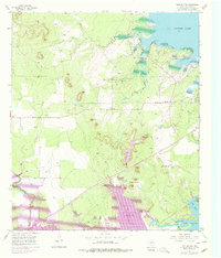
1957 Map of Twin Buttes
USGS Topo · Published 1978About this map
The Middle Concho River valley south of San Angelo is defined here by its mid-century transformation into a major water management hub. This 1957 survey, updated with late-1970s revisions, illustrates the expansive Twin Buttes Reservoir and its relationship to the older Lake Nasworthy downstream. The landscape is a mix of industrial resource extraction and spiritual landmarks, featuring the Pulliam Oil Field and scattered Gravel Pits alongside the Chapel-on-the-Hill. The Atchison Topeka and Santa Fe railroad cuts a straight diagonal across the southwestern terrain, bypassing the distinctive natural rises of the Twin Buttes. Further north, the shoreline of O C Fisher Lake meets the jagged topography near Pulliam Pt, while a network of service infrastructure like Arden Road and various pipelines connect the oil-producing uplands to the river basin.
Find a feature on this map
15 named features on this map. Tap any name to fly to it.
Don’t see what you’re looking for? This feature index may not catch every label — zoom into the map to look around manually.
Map Details
Editions of this 1957 Twin Buttes Map
4 editions found

Other maps of this area

1891 · Hayrick
USGS Topo · 1:125,000

1892 · San Angelo
USGS Topo · 1:125,000

1894 · Hayrick
USGS Topo · 1:125,000

1895 · Sherwood
USGS Topo · 1:125,000

1924 · San Angelo 2-c
USGS Topo · 1:48,000

1924 · Sherwood 1-d
USGS Topo · 1:48,000

1924 · San Angelo 2-b
USGS Topo · 1:48,000

1924 · Sherwood 1-a
USGS Topo · 1:48,000

1928 · Wall
USGS Topo · 1:62,500

1928 · Tankersly
USGS Topo · 1:62,500