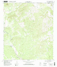
1969 Map of Twin Hollow
USGS Topo · Published 1992About this map
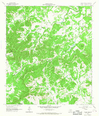
Hondo Creek carves a significant path through this landscape, flanked by notable landmarks like Eagle Bluff and Barnes Bluff. The 1969 topography reveals an area defined by its water sources and high points, such as Bond Flag Mountain and the distinct Ney Cave. The presence of named waterholes, including Wide Crossing Waterhole, Barnes Bluff Waterhole, and Two Pecan Waterhole, suggests the critical importance of reliable water for ranching or travel in this portion of the Texas Hill Country. The terrain is further detailed by drainage systems like Bandera Creek and West Verde Creek, while a Gaging Sta along the creek indicates the ongoing management of these vital water resources. The county line between Bandera and Medina Counties divides the northern and southern sections of the map, providing a clear reference for genealogical researchers looking at family landholdings across these borders.
Find a feature on this map
15 named features on this map. Tap any name to fly to it.
Don’t see what you’re looking for? This feature index may not catch every label — zoom into the map to look around manually.
Map Details
Editions of this 1969 Twin Hollow Map
Other maps of this area

1954 · San Antonio
USGS Topo · 1:250,000

1956 · Sabinal
USGS Topo · 1:62,500

1956 · New Fountain
USGS Topo · 1:62,500

1956 · Tarpley
USGS Topo · 1:62,500

1956 · Bandera
USGS Topo · 1:62,500

1957 · San Antonio
USGS Topo · 1:250,000

1964 · Bandera
USGS Topo · 1:24,000

1964 · Timber Creek
USGS Topo · 1:24,000
1964 · Tarpley
USGS Topo · 1:24,000
1964 · Tarpley Pass
USGS Topo · 1:24,000