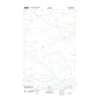
2011 Map of Twin Lakes
USGS Topo · Published 2011About this map
The Teton River flows through this Teton County landscape, where the foothills of the Rockies meet the plains in a pattern of wide-ranging cattle ranches and seasonal waterways. Several family-named properties, including Knowlton Ranch, Pollock Ranch, and Clark Brothers Ranch, are connected by a network of gravel routes such as Blackleaf Rd and Knowlton Rd. This 2011 survey captures the area's vital water management infrastructure, most notably the Twin Lakes Dam which regulates Twin Lakes. The terrain is marked by distinctive geological features such as Frenchy Gulf and Chicken Coulee, illustrating the erosional character of the Montana plains. Farther south, Pebbles Rd and Bellview Teton Rd provide access to Olson Ranch and Hughes Ranch, reflecting a persistent ranching economy defined by the availability of water from sources like Blacktail Creek and Clark Fork Muddy Creek.
Find a feature on this map
22 named features on this map. Tap any name to fly to it.
Don’t see what you’re looking for? This feature index may not catch every label — zoom into the map to look around manually.
Map Details
Editions of this 2011 Twin Lakes Map
This is the sole edition of this map. No revisions or reprints were ever made.
Other maps of this area

1903 · Saypo
USGS Topo · 1:125,000

1914 · Heart Butte
USGS Topo · 1:125,000

1918 · Heart Butte
USGS Topo · 1:125,000

1920 · Choteau
USGS Topo · 1:125,000

1920 · Dupuyer
USGS Topo · 1:125,000

1936 · Pendroy
USGS Topo · 1:48,000

1941 · Pendroy
USGS Topo · 1:62,500

1955 · Choteau
USGS Topo · 1:250,000

1957 · Choteau
USGS Topo · 1:250,000

1958 · Choteau
USGS Topo · 1:250,000