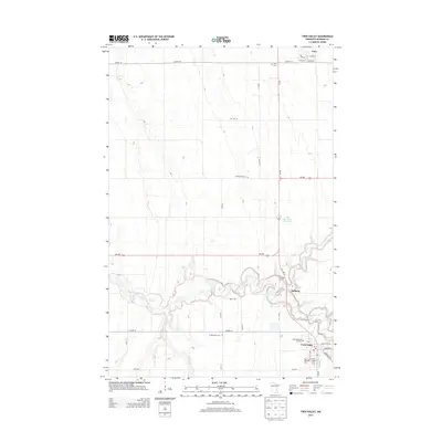
2013 Map of Twin Valley
USGS Topo · Published 2013About this map
Twin Valley serves as the primary population center in this part of Norman County, situated at the southern edge of the map near the intersection of MN-32 and Co HWY-27. The landscape is dominated by the meandering course of the Wild Rice River, which snakes across the southern half of the sheet, feeding the Wild Rice River Reservoir and joined by smaller tributaries like Mushaug Cr and Coon Cr. The agricultural character of the region is evident in the rectilinear grid of township roads and the small, scattered settlements of Gary to the north and Heiberg along the river.
Find a feature on this map
37 named features on this map. Tap any name to fly to it.
Don’t see what you’re looking for? This feature index may not catch every label — zoom into the map to look around manually.
Map Details
Editions of this 2013 Twin Valley Map
This is the sole edition of this map. No revisions or reprints were ever made.
Other maps of this area

1918 · Twin Valley
USGS Topo · 1:62,500

1918 · Flom
USGS Topo · 1:62,500

1918 · Ulen
USGS Topo · 1:62,500

1952 · Grand Forks
USGS Topo · 1:250,000

1956 · Grand Forks
USGS Topo · 1:250,000

1965 · Waukon
USGS Topo · 1:24,000

1965 · Twin Valley SW
USGS Topo · 1:24,000

1965 · Twin Valley
USGS Topo · 1:24,000

1965 · Syre
USGS Topo · 1:24,000

1965 · Twin Valley NW
USGS Topo · 1:24,000