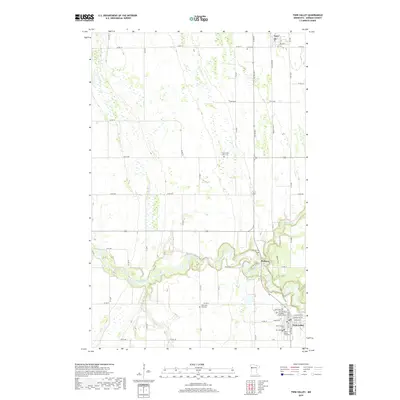
2019 Map of Twin Valley
USGS Topo · Published 2019About this map
The Wild Rice River meanders through the heart of this Norman County landscape, creating a distinct riparian corridor that breaks the geometric grid of agricultural roads. The settlement of Twin Valley serves as a primary anchor in the southeast, where a high concentration of community landmarks such as Twin Valley City Cem, Zion Memorial Gardens, and Saint Williams Cem are located. Further north, the smaller hamlets of Heiberg and Gary line the eastern edge of the quadrangle, connected by the historically significant Agassiz Trail. The map is particularly notable for its numerous burial grounds scattered across the countryside, including North Wild Rice Cem and West Wild Rice Cem, which provide essential touchpoints for genealogical research. Smaller waterways like Mashaug Cr and Coon Cr feed into the river system, defining the drainage patterns of this fertile prairie region during the late 2010s.
Find a feature on this map
55 named features on this map. Tap any name to fly to it.
Don’t see what you’re looking for? This feature index may not catch every label — zoom into the map to look around manually.
Map Details
Editions of this 2019 Twin Valley Map
This is the sole edition of this map. No revisions or reprints were ever made.
Other maps of this area

1918 · Twin Valley
USGS Topo · 1:62,500

1918 · Flom
USGS Topo · 1:62,500

1918 · Ulen
USGS Topo · 1:62,500

1952 · Grand Forks
USGS Topo · 1:250,000

1956 · Grand Forks
USGS Topo · 1:250,000

1965 · Waukon
USGS Topo · 1:24,000

1965 · Twin Valley SW
USGS Topo · 1:24,000

1965 · Twin Valley
USGS Topo · 1:24,000

1965 · Syre
USGS Topo · 1:24,000

1965 · Twin Valley NW
USGS Topo · 1:24,000