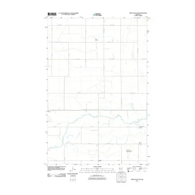
2010 Map of Twin Valley SW
USGS Topo · Published 2010About this map
The Wild Rice River meanders across this rural Norman County landscape, defining the character of the terrain just east of Ada. This 2010 survey illustrates a region shaped by agricultural traditions and early social structures, most notably evidenced by the presence of the Norman County Poor Farm Cemetery. Such sites provide a direct link to the history of local indigent care in the late 19th and early 20th centuries. Further south, the Norman County/Ada-Twin Valley Airport serves as a modern transportation hub for the surrounding townships. The area is marked by a high density of rural burial grounds, including the Skandinavia Cemetery, Saint John's Cemetery, and West Wild Rice Cemetery, many of which were established by early ethnic church congregations. A grid of county highways, such as County Hwy-19 and County Hwy-24, connects these historic landmarks with the seasonal flows of the Marsh River.
Find a feature on this map
26 named features on this map. Tap any name to fly to it.
Don’t see what you’re looking for? This feature index may not catch every label — zoom into the map to look around manually.
Map Details
Editions of this 2010 Twin Valley SW Map
This is the sole edition of this map. No revisions or reprints were ever made.
Other maps of this area

1918 · Twin Valley
USGS Topo · 1:62,500

1918 · Ulen
USGS Topo · 1:62,500

1924 · Ada
USGS Topo · 1:62,500

1952 · Grand Forks
USGS Topo · 1:250,000

1956 · Grand Forks
USGS Topo · 1:250,000

1965 · Lockhart
USGS Topo · 1:24,000

1965 · Twin Valley SW
USGS Topo · 1:24,000

1965 · Twin Valley
USGS Topo · 1:24,000

1965 · Syre
USGS Topo · 1:24,000

1965 · Twin Valley NW
USGS Topo · 1:24,000