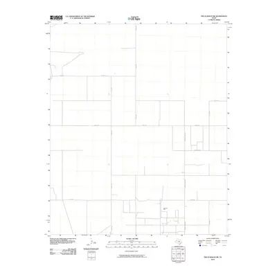
2010 Map of Two B Ranch SW
USGS Topo · Published 2010About this map
The Sable Oil Field defines the industrial footprint of this portion of Yoakum County, reflecting the region's enduring connection to petroleum extraction. This 2010 survey illustrates a highly structured landscape of the Texas High Plains, where the terrain is organized by a precise grid of rural thoroughfares. These routes, including Co Rd 100, Co Rd 130, and Co Rd 160, facilitate transport through the expansive ranching and oil-producing territory. Named local paths such as Johnnie Layton Rd and Carpenter Rd provide specific geographical markers for family-based land research and local history, highlighting the intersection of industrial development and long-standing rural property boundaries in West Texas.
Find a feature on this map
10 named features on this map. Tap any name to fly to it.
Don’t see what you’re looking for? This feature index may not catch every label — zoom into the map to look around manually.
Map Details
Editions of this 2010 Two B Ranch SW Map
This is the sole edition of this map. No revisions or reprints were ever made.
Other maps of this area

1954 · Brownfield
USGS Topo · 1:250,000

1958 · Brownfield
USGS Topo · 1:250,000

1962 · Brownfield
USGS Topo · 1:250,000

1970 · Prairieview NE
USGS Topo · 1:24,000

1970 · Bronco NE
USGS Topo · 1:24,000

1970 · Bronco
USGS Topo · 1:24,000

1971 · Plains NW
USGS Topo · 1:24,000

1971 · Schooler Ranch
USGS Topo · 1:24,000
1971 · Plains
USGS Topo · 1:24,000
1971 · Two B Ranch
USGS Topo · 1:24,000